


Drone Surveying: FIELDNOTES
Levelling the Field.
Following England’s latest football disappointment, we turned our attention to something considerably easier to settle with data: whether a newly constructed football pitch was actually level.
Football has a long history of uneven playing fields – sometimes quite literally. Yeovil Town’s former Huish ground was famous for a substantial slope across its pitch. Wycombe Wanderers’ old Loakes Park reportedly fell by around 11 feet from one side to the other, while Grundy Hill, the former home of Horwich RMI, was reputed to drop approximately 16 feet diagonally.
More recently, players and coaches at the 2026 World Cup have raised concerns about the feel, hardness and consistency of some of the temporary grass surfaces installed in American stadiums.
Fortunately, there should be rather less to complain about on this new pitch.
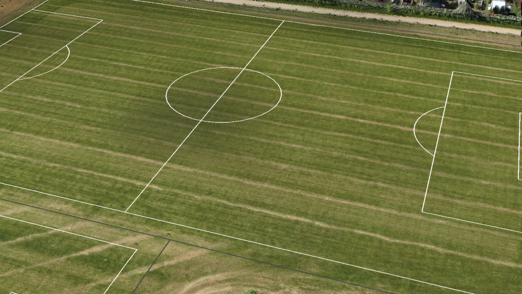
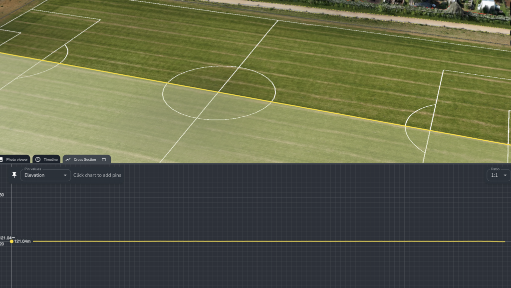
As part of our survey of a residential development, the client asked us to measure the completed football pitch and confirm whether there was any meaningful change in level across its length. Using the latest georeferenced survey model, we drew a grade measurement along an alignment extending just over 100 metres from one end of the playing surface to the other.
The result was reassuringly uneventful: the platform returned an average gradient of 0%, with the cross-section remaining effectively level along the measured alignment.
Across the measured 100-metre alignment, the survey returned an average gradient of 0% – providing the client with clear, measurable evidence of the completed pitch profile.
Checking the Finished Surface
A sports pitch forms a substantial part of the completed external works and may also represent an important planning, amenity or handover requirement for the wider development.
Its finished levels can influence how the facility performs, including the movement of surface water and the consistency of the playing area. The relevant requirement will depend on the approved design, drainage strategy and specification: not every pitch is intended to be completely flat, and some are deliberately constructed with a controlled gradient or crown.
The important point is therefore not to assume that level is always correct, but to establish whether the completed surface corresponds with the intended design.
In this case, the requested check was made along the pitch’s length. The survey provided a continuous elevation profile across the selected alignment, allowing any sustained rise, fall or abrupt variation to be seen directly.
More Than a Spot-Level Check
Individual spot levels are useful, but they only describe the surface at the specific positions measured.
A drone survey captures elevation data across the wider playing area. This allows the client and project team to examine the overall terrain model, draw measurements in different directions and investigate any area where the surface profile warrants closer attention.
The platform can be used to review longitudinal and transverse gradients, compare different parts of the playing surface and create cross-sections through selected alignments. Where design information is available, the completed terrain can also be assessed against the intended finished levels.
This gives the project team a much clearer picture than a photograph of a pitch that simply appears flat from ground level.
A Result Nobody Needs to Argue About
The survey does not assess the quality of the turf, the performance of the drainage system or the pitch against a particular sporting standard unless those elements form part of the agreed scope and relevant design information has been supplied.
What it does provide is an accurate spatial record of the surface at the time of survey.
For this pitch, the measured profile gave the client straightforward evidence that there was no meaningful end-to-end gradient along the selected alignment.
So, while debate may continue over substitutions, tactics, temporary World Cup surfaces and whether the ball really did take an unexpected bobble, this particular result is rather more conclusive.
The pitch is level. The playing field is fair.

Reviewing Completed Works with CheckPoint
This is one of the ways our CheckPoint service can turn survey data into useful information for technical, engineering and construction teams. Rather than leaving the survey as a passive site record, specific features can be measured and reviewed against the relevant drawings, levels and project requirements.
On sites surveyed regularly, CheckPoint also provides a consistent record of external works as they develop. Levels, alignments and completed features can be reviewed while work remains visible and before subsequent landscaping, surfacing or handover activities make investigation more difficult.
Need to settle a question with site data?
Drone Surveying helps housebuilders measure and review roads, plots, drainage features, public open spaces, sports pitches and other external works using an accurate, georeferenced record of the development.
Through our CheckPoint service, we can also examine specific areas against the available design information and highlight features that may warrant closer review.
Discover more about CheckPoint and our drone surveying services


