


Drone Surveying: FIELDNOTES
Pushing the Boundaries…
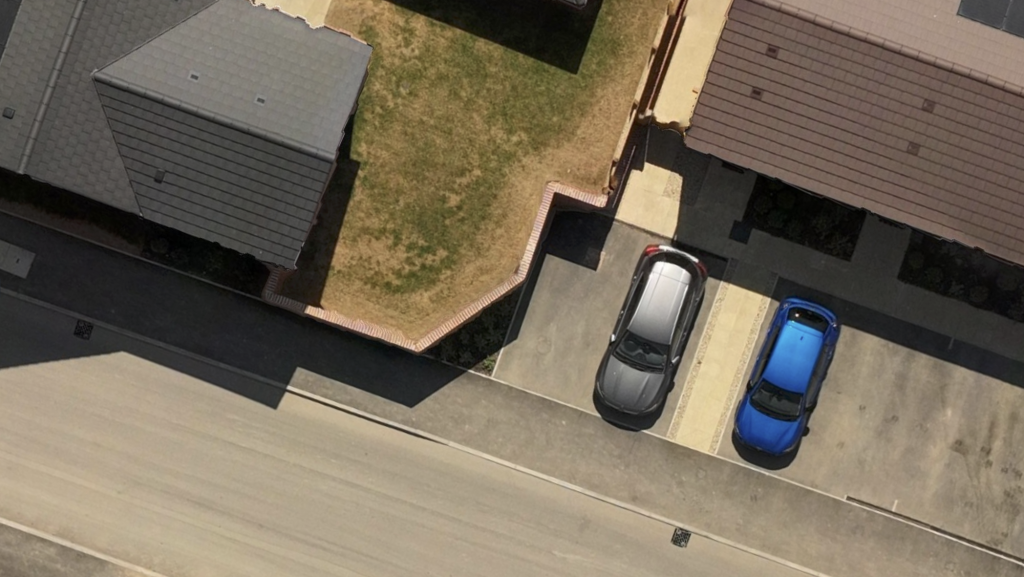
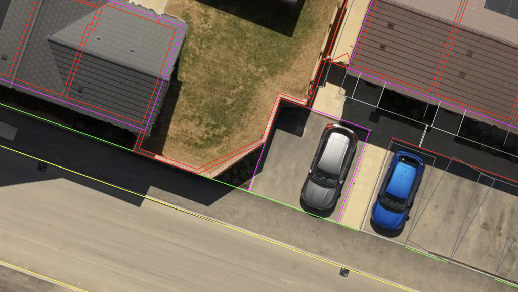
A recent drone survey and CAD comparison highlighted a section of boundary wall that had been constructed at a different angle from that shown on the supplied layout.
Across the surrounding area, the completed properties, driveways and external works aligned closely with the design. One feature, however, stood out during the review. The CAD drawing showed an angled return in the boundary wall between the rear garden and the adjoining driveway. When the layout was overlaid onto the latest georeferenced drone survey, the as-built wall could be seen following a distinctly different line. Rather than turning at the position and angle shown on the drawing, the wall began its diagonal section earlier and followed a shallower route. This changed the intended shape of the garden and created a clear difference between the designed and completed plot geometry.The orthomosaic provided an accurate record of the completed works. The CAD overlay turned that record into a direct as-built comparison, making the change in alignment immediately visible.
Why the Difference May Matter
A boundary wall constructed at a different angle may initially appear to be a relatively minor variation. However, external boundaries determine the final geometry of a completed plot. A discrepancy of this kind could affect the garden area, the relationship between neighbouring plots, the shape of the adjoining driveway and the accuracy of information used during plot completion, conveyancing and handover. It may also become more difficult and costly to investigate or correct once landscaping, fencing, planting and other finishing works have been completed. The survey cannot determine why the difference occurred. It may have resulted from a setting-out error, an approved site amendment or a revised drawing that was not included within the information supplied for comparison. What it provides is clear, measurable evidence that the completed wall does not correspond with the drawing being reviewed, allowing the relevant site and engineering teams to investigate the difference against the latest approved design.Making the Difference Visible
From ground level, the wall may appear straight, well constructed and consistent with the surrounding external works. Without the intended alignment shown alongside it, the difference in angle may not be immediately apparent. Drone Surveying creates a current, georeferenced record of the development as it has actually been built. Overlaying the relevant CAD information allows buildings, roads, driveways, boundaries and other constructed features to be compared directly with their intended positions. This moves the survey beyond general progress imagery. Instead of simply documenting what is on site, it helps identify specific areas where the completed development may not correspond with the supplied design.Identifying Issues Before They Become Embedded
This type of comparison does not replace the engineer, determine contractual responsibility or make a final judgement on compliance. Its value lies in identifying discrepancies while they can still be reviewed and, where necessary, addressed. Regular drone surveys create a measurable record as construction progresses. When that record is compared with the latest design information, differences can be identified before they are obscured by later works or carried forward into completed plots. In this section of the development, the angled wall was the clear exception within an otherwise well-aligned area. The CAD overlay isolated that discrepancy immediately and provided the evidence needed for a more detailed review.
Reviewing the Detail with CHECKPOINT
This is the purpose of our CheckPoint service. Rather than allowing survey data to remain a passive record, CheckPoint provides a structured review of the latest site information against the relevant drawings and previous surveys, highlighting potential snags that may warrant closer attention.
On sites we survey regularly, this ongoing review is particularly valuable. Changes can be tracked from one visit to the next, allowing potential issues to be identified while work is still progressing and before further construction, landscaping or finishing works make them more difficult and costly to resolve.
What could your latest survey reveal?
Drone Surveying helps housebuilders compare current site conditions with engineering and layout information, giving technical, commercial and construction teams a clearer understanding of how the development is progressing against design. Through our CheckPoint service, regularly surveyed sites benefit from an additional layer of review designed to identify potential snags early, while there is still time to investigate and address them before they become costly.Discover more about CheckPoint and our drone surveying services


